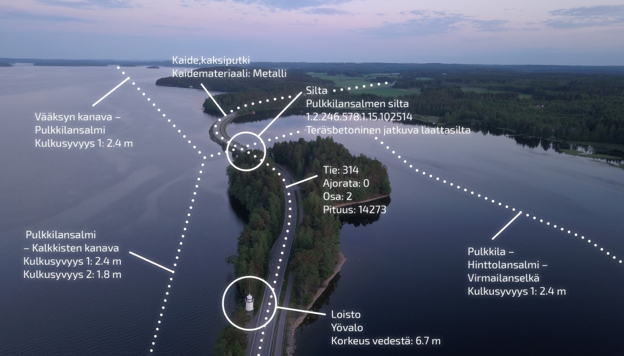
Tievelho and Digiroad
Road network data is maintained in FTIA's Tievelho system. Open road network data is sourced weekly from Tievelho, and the open data includes e.g. spatial data about the road network, assets, structures and verdicts.
Digiroad on on the other hand is a national database that contains the geometry of the Finnish road and street network featured with the most important road attribute data. The Digiroad operator maintains their own webpage, where one can find lots of information regarding the Digiroad data.
Road network and Digiroad data from whole Finland can be found from the open data platform for downloading datasets:
Digiroad (Shapefile and GeoPackage-formats)
Road network (shapefile)
More information regarding road network data can be found via the following links:
Road adress system (in Finnish)
Digiroad
Road traffic accidents
FTIA gathers annual data on road traffic accidents based on information from the police and completes them with data from Statistics Finland.
More information and download of the data (avoindata.fi)
QGIS-library for traffic signs
Finnish traffic signs are now published as an open QGIS-library (SVG vector format) in GitHub (Note! BETA-version, documentation in Finnish only). The collection includes former traffic signs and the new ones from the new Road Traffic Act (1.6.2020) and a QGIS-script for visializations. Traffic signs are named by their unique code: more information can be found on FTIA's webpage for traffic signs.